Virtual Morgantown Project
Virtual Morgantown - reconstructing an historic landscape
Our goal for the project was to develop a virtual reconstruction of a historical landscape using GIS data and 3D models that could be used as a platform for exploring that landscape. To begin the project, we assembled the data necessary to generate building footprints, ground surface, and vegetation/street furniture for downtown Morgantown c.1900. Morgantown, West Virginia, was a small regional city on the Monongahela River that was experiencing rapid urban growth in the early 1900s due to the expanding coal industry, lead glass manufacture, the coming of the railroad, and related commercial activities. These growing industries spurred a building boom in the downtown area of Morgantown. In more recent years, many of these structures have been lost as the city has undergone urban regeneration.
The primary goal of this project is to create a digital reconstruction of the historical urban landscape of Morgantown that is rapidly disappearing. The project drew heavily on the historic Sanborn fire insurance maps published in 1899 and 1904, as well as historical photographs of the downtown area. The building footprints, streets, and lot boundaries were all digitized into ESRI shapefile format using ESRI's ArcGIS software.
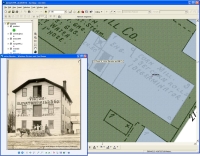
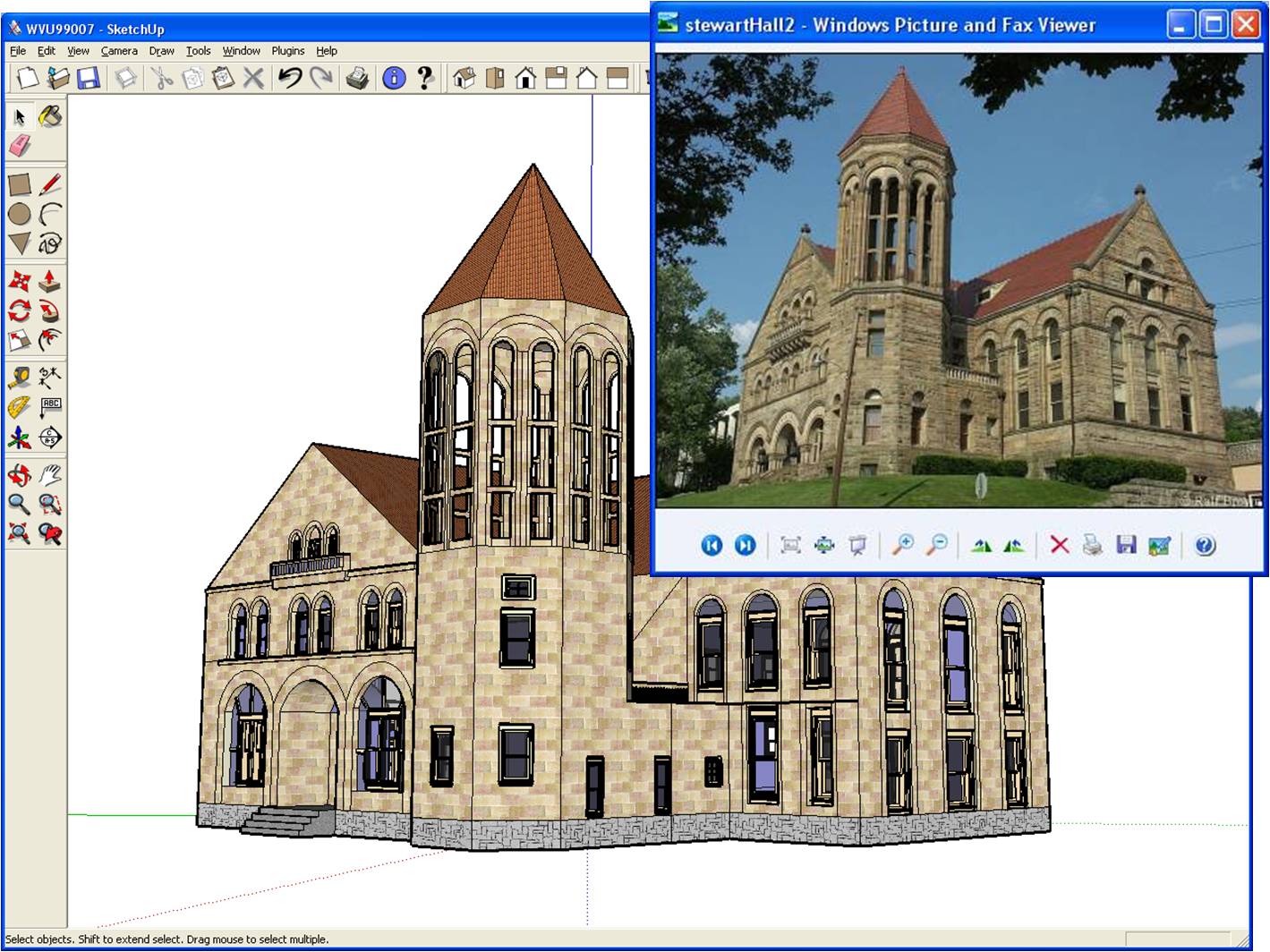
The digitized footprints were imported into SketchUp 5 Pro using the Shapefile Importer. Historical as well as contemporary photographs were used to aid in the construction of the 3D building models. The completed models were imported into a custom ESRI style gallery and linked to the GIS data layer of structure locations. Over 300 custom SketchUp models were generated and imported into ArcGIS.
In addition to the 3D structure layer, several other GIS layers were generated to populate the virtual landscape, including ground surface, streets, trees, and street furniture. The completed scene offers a visual representation of Morgantownâ??s landscape at the turn of the 20th century, and allows users to explore the physical elements of this fascinating cultural landscape.
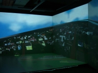
In August 2006, the GeoVirtual Laboratory, also housed within the Department of Geology and Geography at WVU , working with Mechdyne Corporation subsidiaries Fakespace Systems Inc. and VRCO Inc., completed the installation of a four-wall immersive visualization system. The FLEX system is a room-sized interface consisting of rear-projected front, left and right walls and a ceiling-mounted floor projection. With this new Virtual Reality system, users can explore the virtual reconstruction of historical Morgantown in an immersive 3D environment and experience the SketchUp models and urban landscape as if they were there in the scene.